Map Viewer: Glaciology Radar Data
An interactive map viewer for radar data has been developed and implemented in cooperation with AWI Glaciology and the radar team led by Prof. Olaf Eisen. Standard conformity, metadata filters and links to a data repository contribute to the commitment to the FAIR principles.
Glaciology is the science of ice and snow in all their forms. The example of ice sheets illustrates their importance: they are the largest freshwater reservoirs on Earth, and their decline as a result of the rapid warming of the Earth's climate due to human activities will dominate the rise in sea levels in the coming decades to centuries. At the same time, they are unique climate archives that make it possible to analyse the climate and composition of the atmosphere in the past and compare it with the present.
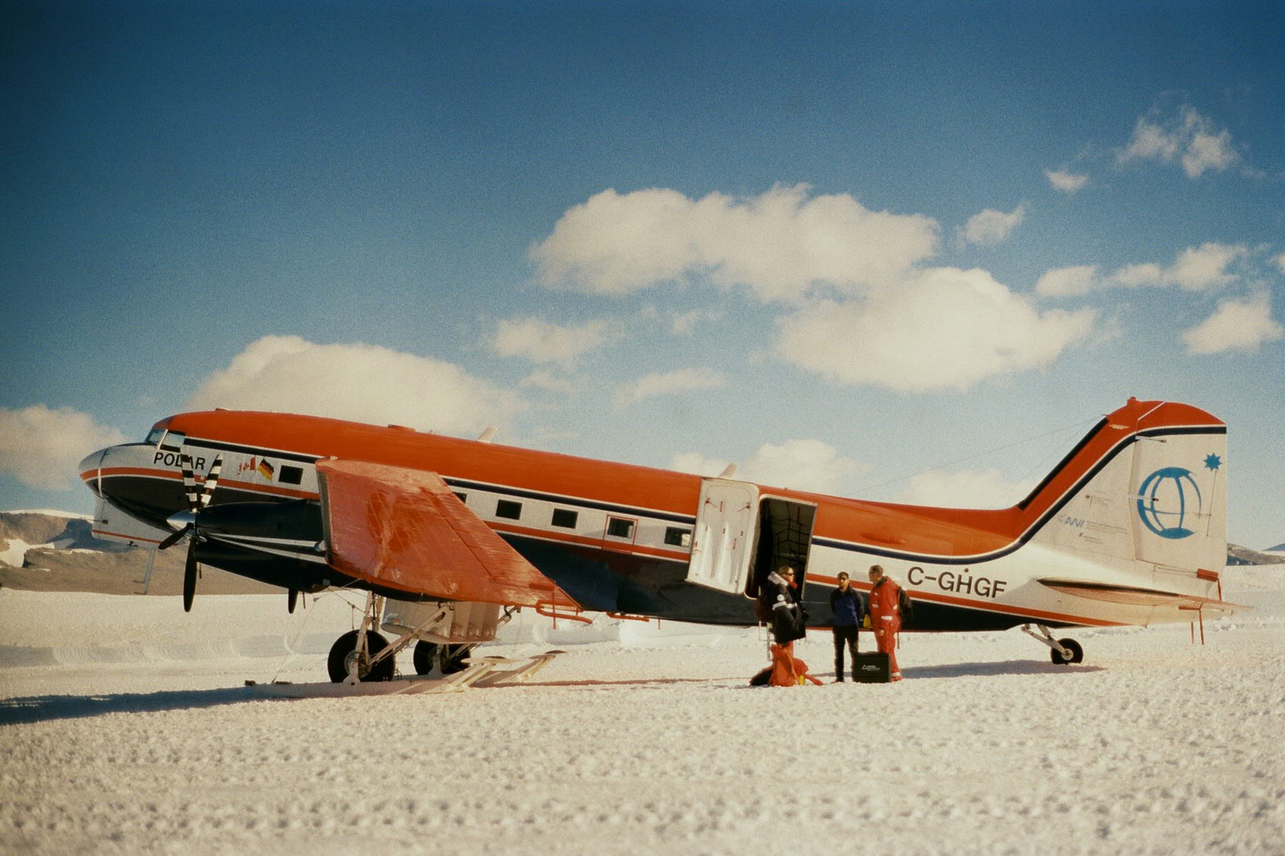
An entire section at Alfred Wegener Institute (AWI) is dedicated to this discipline, using geophysical methods such as radar measurements. This method has been in use at AWI since the mid-1990s and makes particular use of the AWI aircrafts Polar 5 and Polar 6. Over the last three decades, numerous flights in the Arctic and Antarctic have accumulated radar flight lines with a length of almost half a million kilometres, which are now being made publicly accessible. The map viewer, which was realised together with the AWI's Field Glaciology department, can be accessed via the Marine Data portal:
https://marine-data.de/viewers/d181f76f-fa15-44c9-8452-07540c72e0be
The cartographic overview of radar data shows flight lines, annotated with flight metadata and quick views of the actual radar data. It is possible to filter by location, time of data collection and all other metadata provided, such as the measurement campaign. Where already available, references are provided to a data publications in the PANGAEA repository, which now accompanies scientific publications by default, such as https://doi.org/10.1594/PANGAEA.928569.
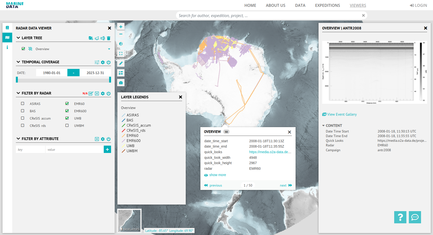
Technically, the map viewer is based on software continuously being developed and infrastructure hosted by the AWI computing and data centre. The web frontend is an instance of the Visual Exploration Framework (VEF) and works with geodata services of the O2A spatial data infrastructure (SDI). VEF is a framework for interactive map viewers, which is currently being further developed in the MareHUB and DataHUB context and whose source code is available to the public under an open-source licence. The standard-compliant geodata services (especially OGC WMS) are made publicly available and can also be integrated into any GIS client. The O2A SDI also relies on open-source software.
The content (data and metadata) is provided by the Glaciology department and is to a large extent updated automatically by the O2A SDI. This happens in a process based on the corresponding standard operating procedures, defining a data exchange protocol (format, location) and data visualisation.
In addition to our own scientific publications, this data is to be made available to the international research community as easily as possible for further analyses. This is part of an international co-operation, e.g. with UK as US institutes, which handle their flight data in the same way. As the current issues in glaciology - starting from individual regions - are increasingly extending to the entire ice sheets, for example in the current projects of the Scientific Committee for Antarctic Research Bedmap3 or AntArchitecture, standardised access to the data results in low-threshold reusability.
Outlook
In the future, metadata and data from other current flight campaigns and historical measurement campaigns with ground-based radar will be successively published FAIR compliant on PANGAEA and made explorable via the map viewer on Marine Data and Earth Data. In addition, the experience gained with the current procedure will be transferred to other systems and data, e.g. radar for sea ice exploration or other remote sensing imaging methods operated on AWI aircraft.
With a broader range of metadata, the filtering options will also be expanded.
Contact
Content: Olaf Eisen
Technology: o2a-support [awi] awi.de